
You can access the Family Tree Map App at any time by clicking the "Go To Maps" link located at both the top and bottom of any page when logged into your account. After logging in successfully, you’ll also be redirected to the Map App automatically.
Begin by selecting your state and county of interest from the dropdown menus, then click "Load Map". The map will display all parcels for the selected county in a zoomed-out view.
Use the +/- buttons in the top-left corner of the map or your mouse’s scroll wheel to zoom in and out.
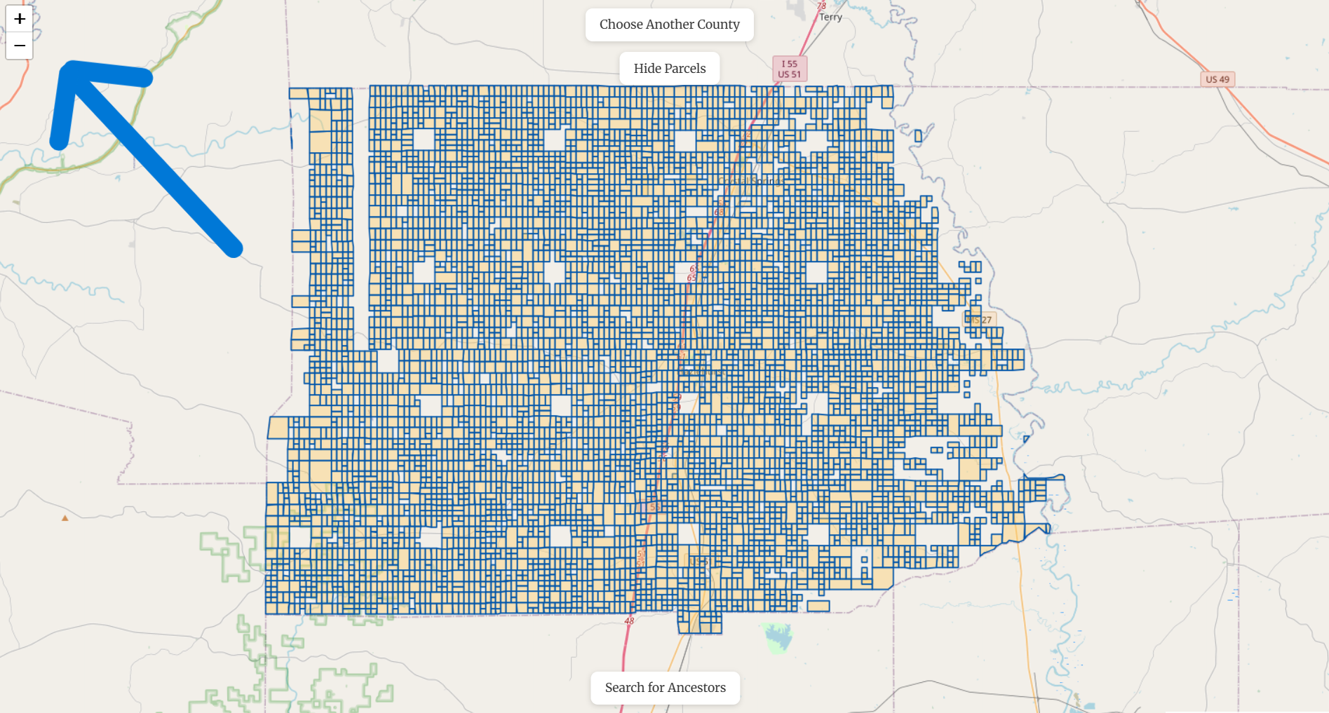
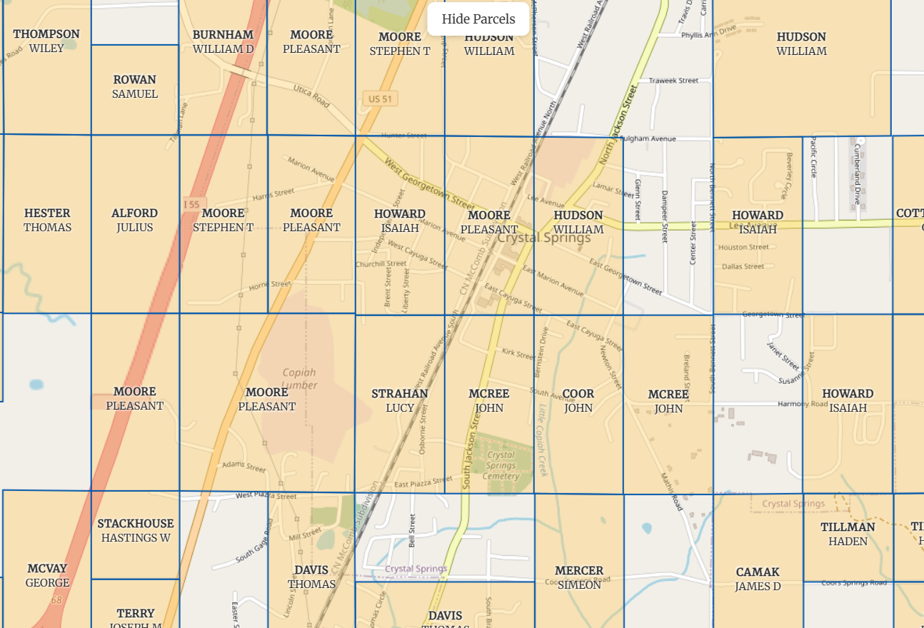
To see ancestor names, zoom in on your area of interest. Names will only appear at certain zoom levels to prevent map clutter. You can pan the map by clicking, holding, and dragging.
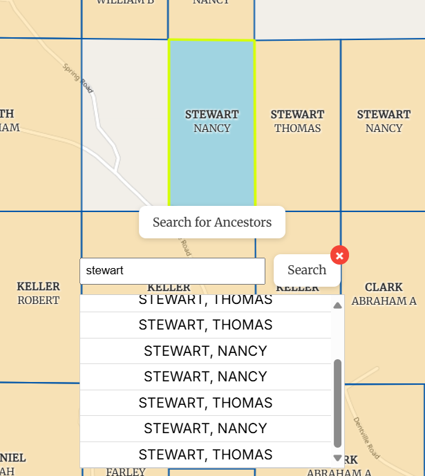
Click "Search for Ancestors" at the bottom of the screen to start a search. Enter a surname, then click Search or press Enter. Our fuzzy search technology also returns alternate spellings of the surname. Search results list each parcel linked to a matching name. Clicking on a name will automatically zoom to that parcel. The search results remain visible so you can click through other matches.
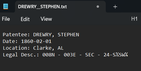
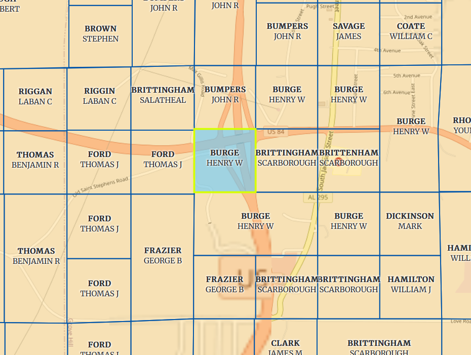
Clicking on a parcel opens a pop-up with details including: Original patentee’s name, Patent issue date, Location name, Legal land description and other individuals associated with the parcel (co-patentees and warrantees)
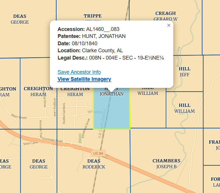
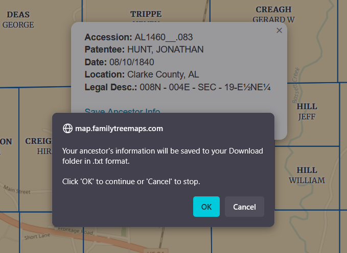
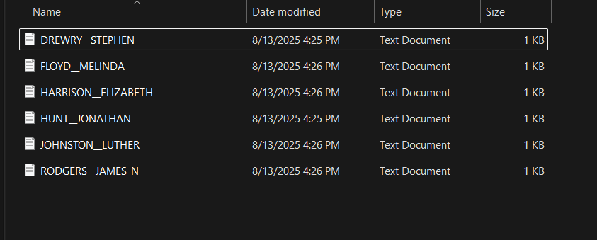
Inside the parcel pop-up, click "Save Ancestor Info" to download the parcel details as a .txt file. Depending on your browser and device, the file will save to your Downloads folder or another chosen location. This makes it easy to store and incorporate the data into your other research.
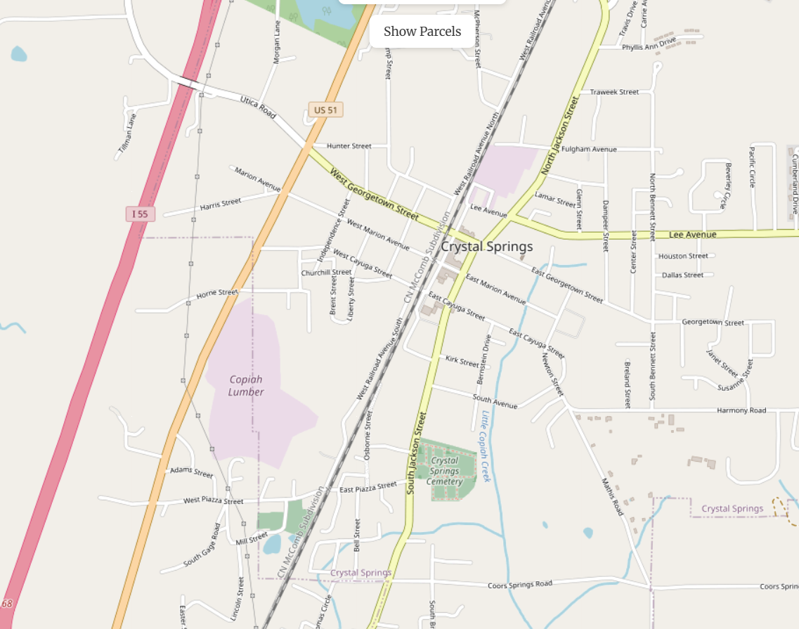
The app uses a modern OpenStreetMap basemap beneath the ancestor parcels. It shows streets, towns, water features, and points of genealogical interest such as cemeteries and historic sites. To temporarily hide ancestor parcels and view only the modern map, click "Hide Parcels" under the Choose Another County menu. Click "Show Parcels" to make them visible again.
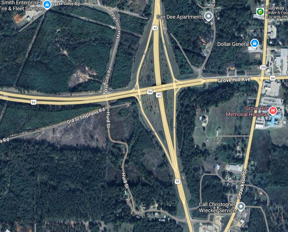
To see a parcel in Google’s satellite view, click on the parcel to open its pop-up, then select "View Satellite Imagery". This will open maps.google.com in a new browser tab or window and automatically zoom to the parcel’s location.
For additional questions or feedback, please use the contact form on our Contact page.