Family Tree Maps connects names, land, and history to bring your genealogy research to life. While traditional records may tell you a family lived in a certain county or town, Family Tree Maps take you further—pinpointing the exact parcel of land where your ancestors settled, worked the soil, built homes, and raised generations, transforming vague locations into specific places, giving you a clear view of your family's original homestead and the landscape that shaped their lives.
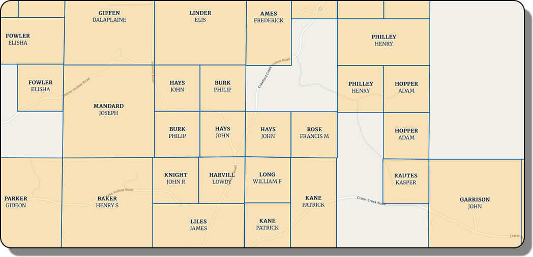
At its core, Family Tree Maps is both a visual and archival tool that uncovers the original layout of land ownership in a county during the early years of settlement. Instead of relying on broad location references like "Clark County, Indiana," we show the exact parcels your ancestors claimed and lived on, which are based on General Land Office Records from the Bureau of Land Management, US Department of the Interior.
Family Tree Maps uses the PLSS, a historic surveying method that divided much of the U.S. into uniform grids made up of townships and sections. This structure allows land to be precisely described and consistently mapped—so you can find the exact location of a land claim from 150+ years ago with modern accuracy.
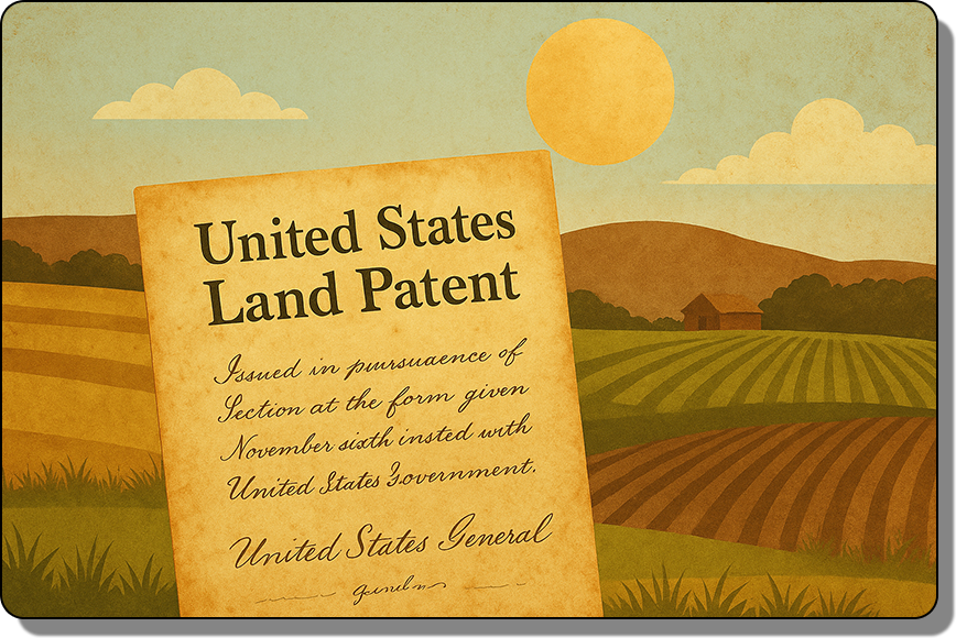
Every parcel shown on Family Tree Maps county maps corresponds to a real federal land patent—the first legal record of ownership—issued to an individual or group of individuals. These maps are not general representations; they are grounded in official land records and depict the real people who first settled the land.
Because names in historical records were often misspelled or written phonetically, the Ancestor Search Index within the map tool includes variations as recorded in the original patent documents. This makes it easier to find ancestors even when their names appear in unexpected forms, and also helps you discover related or neighboring families you might have missed.
Family Tree Maps weaves together the names of your ancestors, the maps of the land they claimed, and the broader historical context of their time. It’s more than just data—it’s a story rooted in place, showing how families took root and communities grew from the ground up.
When direct records are missing or names are hard to trace, nearby landowners can hold the clues. By examining who lived next door or in the same section, you might uncover in-laws, maternal lines, or connections previously buried in the margins of history.
Instead of guessing at a town or county, you can identify the exact plot of land your ancestors once called home. Walk the same fields they farmed, stand at the edge of their old property lines, and connect with your heritage on a deeper, physical level.
Patterns of settlement reveal how families spread across the country—one land patent at a time. Seeing where someone started, and where their relatives later claimed land, can shed light on why they moved, who they followed, and how communities evolved over time.
Knowing the location is just the start—understanding the terrain, the neighbors, the resources, and the distance from towns tells you how your ancestors lived. Whether they settled near a creek or deep in a wooded section, the land itself reveals their resilience, choices, and challenges.
Every landowner listed in historical records is included in a comprehensive alphabetical index. Variations in spelling—like “Jonson,” “Johnson,” or “Johnsen”—are faithfully preserved as they appear in the original documents, helping you locate ancestors even when the spelling isn’t consistent across records.
Each county map is paired with a modern version showing today’s landmarks. Roads, town boundaries, and cemeteries help you align past and present, making it easy to locate an ancestor’s land on today’s landscape or even visit in person.
Each land parcel depicted includes valuable information about the land patent and ancestor such as names, date, document number and Co-Patentees - an important resource for finding lost relationships among settlers.
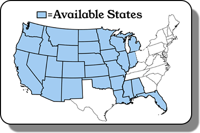
Family Tree Maps is currently available for select counties across states that use the Public Land Survey System, which covers roughly 75% of the United States. That includes most of the Midwest, Great Plains, and Western states. However, it does not apply to the original 13 colonies or regions governed by other systems, such as Texas land grants or Spanish and French claims in the Southwest.
The land parcel data used in this application is derived from historical land patents maintained by the General Land Office Records, Bureau of Land Management, U.S. Department of the Interior. These records are part of the public domain and freely accessible at https://glorecords.blm.gov/default.aspx, which in many cases also provides scans of the original patent documents.
While the source data is public, the compilation, interpretation, and visualization of these records into map form are proprietary works. All maps and the map application are copyright © Ancestor Maps LLC. We strive to ensure accuracy in our data and mapping, but historical records can contain errors and, like any project involving both people and computers, mistakes are always possible. This data is provided for genealogical research and entertainment purposes only and is not intended for legal claims, land title verification, or survey use.